Our role in planning for Open Space & Mountain Park lands just west of town...

1. Learning the interests of those who live near Open Space
2. Bringing those interets to the planning process
3. Searching for mutually beneficial solutions


Sunday, January 2, 2011

Last CCG Meeting

The last CCG meeting will be held January 6th, 6-9 PM. Several undecided items will be discussed. Subsequent meetings will be before the Open Space Board of Trustees. For a listing of meetings, go here:
http://www.bouldercolorado.gov/index.php?option=com_content&view=article&id=13324&Itemid=3763

Winter Solstice dawn (click on photo for a larger version):

Wednesday, December 1, 2010

CCG tentative agreements posted

After much deliberation the CCG has come to consensus on a number of items. Please visit the OSMP web site to review them. The link is here:
 http://www.bouldercolorado.gov/files/openspace/pdf_TSA_West/CCG/CCG_Proposals/CCG_Preliminary_Recommendations_11-30.pdf

Items that are still up for discussion are here:
http://www.bouldercolorado.gov/files/openspace/pdf_TSA_West/CCG/CCG_Proposals/Not-Decided_CCG_Decision_Items_11_30.pdf

The public comment period will be from November 30 - December 12, 2010. A public meeting will be held on December 6, 2010 from 6-9 pm at the East Boulder Recreation Center.

Wednesday, November 17, 2010

Preliminary agreements

The Community Collaborative Group (CCG) has finally negotiated a draft agreement regarding trails and the management of the West TSA. The document will be posted on the OSMP web site November 29, 2010. We will post a link to it then. This agreement will be explained and public input will be sought at an Open House on Monday, December 6, 2010, 6pm to 9pm, at the East Boulder Recreation Center. More information on the agreement and Open House will be posted on the OSMP CCG website.

Sunday, November 7, 2010

Anemone trail before the fire

The Anemone trail starts in the Red Rocks area and heads West. An undesignated trail extends beyond the Anemone trail following the prominent ridge in the area. There is a proposal before the CCG that this trail become a designated trail. The map below shows the trail under consideration - it roughly parallels the dashed red line. Click on any image to see a larger version.


The start of this trail climbs up to the top of the ridge. This is right in the heart of the burned area.


Towards the top of the ridge there are a few piles of quartz, apparently created as diversions.


This is an interesting trail that winds along the ridge cutting through a few rock outcrops.


The trail goes through some open areas with nice views.


Signs of an old fire.
And the persistence of nature.


Heading back East, a view of Dome rock where the fire started.


At one point the trail splits and and goes along both sides of the ridge (see map). This is the Southern side.

Thursday, October 7, 2010

Proposed trail along upper Flagstaff

This trail was proposed and then pulled back because OSMP's mapping showed that its possible influence extended substantially into Highly Suitable Habitat (HSH). Some consider that a slightly steeper tread for the trail would have much less impact.

The map below shows my track. Click on it to see a larger view. Near the lower end of the track there is an old trail that heads slightly downhill to the West.


Traces of an old road or trail are apparent along much of the lower part.


There are some nice views through the trees


More old track


The trail would pass by Lost Gulch overlook


Social trail above Cathedral park


Further up there is a spring. If the trail goes between it and the road it would traverse this slope.


Above the spring the trail would head West and cross the drainage to this view


Turning SW to follow the ridge, an old trail with switchbacks appears


The track intersects the road  near the crest

Friday, August 27, 2010

Proposed trail near Long Canyon

This route will likely be discussed in future meetings. It would climb the ridge North of Long Canyon and connect up with the Green Mountain West Ridge trail.  Click on a picture enlarge it.


If the trail starts climbing before the mouth of Long Canyon it would likely head up through this area.


Another option is to follow the Long Canyon trail a short ways as shown on the map above. Then cut up the ridge to the right just before a rock outcrop that crosses the trail. 


The goal in the distance.


The route on the map parallels the road, eventually crossing a drainage near its head just below this old car.


The route then climbs to the Southwest between Flagstaff road and Long Canyon. It meets the Long Canyon trail as it climbs towards the road.


At the road the route could follow an old dirt road.


It would logically follow some old switchbacks climbing toward the ridge.


Many feathers were found.


The route hits the ridge and bends towards the East to connect with the Green Mountain West Ridge Trail.

Monday, August 2, 2010

Proposed route of West Sanitas Trail

This route has been proposed to replace the social trail in the area. The social trails would be reclaimed.

The start off of Sunshine Canyon road would have to be reworked.


Evidence of an old switchback above a private road.


The trail would parallel Sunshine Canyon road somewhere through here.


 The trail head at the first switchback on Sunshine Canyon would connect with the proposed trail, which would continue heading North.                                                                                             


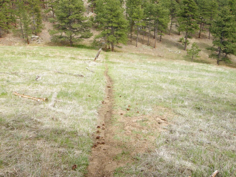
There's an old track North of the switchback. The proposed trail may follow it.


The old track fades into a field of wildflowers.


It gets rocky further up the route.  The trail should probably switchback up to the NE before this.


The route may connect up with a social trail which doesn't appear in the OSMP data base.


Near the NW corner of this part of Open Space the proposed trail would have to climb a bit to a neighborhood trail which does appear in the OSMP inventory. This trail contours back to the SE. This part is actually a nice trail.


There are some nice views from this section.


The neighborhood trail rounds a ridge and would likely contour around to the ridge North of Mount Sanitas - beyond the trees here.

Tuesday, July 20, 2010

Comment Gathering Web Site Launched

The Boulder West TSA neighborhood representatives have just launched a new and improved website for gathering your comments and updating you on the latest developments in the CCG process. This website can be reached at:

http://west-tsa-neighborhood-comments.blogspot.com/

If you're interested in learning more about the CCG, process, adding your name to our mailing list, contributing your insights, or commenting on the various ideas being considered, this is the place to go.

With a few exceptions (listed below) this blog contains older and often outdated information.

Monday, July 5, 2010

Meeting for neighbors who live in the “central” neighborhoods of the West TSA

The Community Collaborative Group (CCG)* is now actively considering a broad range of suggestions for improving the way in which Boulder Open Space and Mountain Parks (OSMP) manages the so-called "West Trail Study Area" (West TSA), which are comprised of OSMP properties in the area north of Eldorado Springs, south of Linden, and west of Broadway / Colorado 93.

Under consideration are suggestions about expanding and/or restricting various types of recreational access with the goals of reducing adverse impacts from visitors on Open Space neighbors, improving the visitor experience while reducing user conflicts and providing physically and environmentally sustainable trail systems. Some of the issues being addressed include the rules under which dogs are allowed access to Open Space properties, the accessibility of the area to mountain bikes, and strategies for handling parking issues and social trails.

If you live west of Broadway/north of Table Mesa/south of Canyon you are considered to be a “neighbor” in the central region of the West TSA. The neighborhood representative for the central region is Shelley Dunbar and she will be hosting an open forum to gather neighbor input on the proposals that will be put forth in the upcoming CCG meetings. If you are interested in voicing your ideas for “on the ground” actions that you would like to see in the West TSA, please join Shelley Dunbar at this neighborhood meeting.

Where: Chautauqua Park “Rocky Mountain Climber’s Club” room (lower level of the Community House)
When: Monday July 19th at 6:30 PM

Please come prepared to share your specific, well-thought out solutions to issues you have as a “neighbor” of Open Space! If you are unable to attend this meeting, you can email your ideas directly to the neighborhood rep at shelley.westtsa@gmail.com.

* To find out more about the Community Collaborative Group go to http://www.bouldercolorado.gov/index.php?option=com_content&view=article&id=11843&Itemid=3763

Change in Time and Location of the July 7th CCG meeting

Change in Time and Location for the July 7th CCG meeting
Please note that the Wednesday July 7th CCG meeting will be held at the West Senior Center at Arapahoe and 9th street (not Cherryvale). We also have a new meeting time, starting at 5:30 and concluding at 9:30pm. Public participation is scheduled for the start of the meeting, so if you plan to speak please arrive by 5:30 PM.
Agenda for this meeting
The agenda is to finish the discussion of proposals for the Sanitas / Anemone Hill / Red Rocks Sub-area. It is important for the CCG to strive for tentative agreement on as many of the proposals as possible, so that the CCG can move on to the next sub-area.
· At Wednesday's meeting it is possible that the CCG will finish the Sanitas / Anemone Hill / Red Rocks Sub-area before the end of the meeting. If that is the case, the CCG will begin discussion of ideas and possibilities for the Western Mountain Parks / Flagstaff Sub-area, with the starting point being proposals already made by CCG members.

Monday, June 14, 2010

Undesignated trails West of Sanitas

Below are some pictures of undesignated (social) trails West of the Sanitas area.  These trails are currently being discussed by the CCG. They could be left as is, some of them could be reclaimed, some of them could be re-routed, and some of them could become designated.

The ridge North of Mount Sanitas


Outcrops along the ridge


Looking East back towards the Mount Sanitas ridge


Looking West from the high ridge in the Northern part of the undesignated trail area.


Undesignated trail heading NW in the Northwestern part of the area.


Heading back towards Mount Sanitas ridge along the fence line


Steep part of the trail back up to the ridge.