Our role in planning for Open Space & Mountain Park lands just west of town...

1. Learning the interests of those who live near Open Space
2. Bringing those interets to the planning process
3. Searching for mutually beneficial solutions


Thursday, October 7, 2010

Proposed trail along upper Flagstaff

This trail was proposed and then pulled back because OSMP's mapping showed that its possible influence extended substantially into Highly Suitable Habitat (HSH). Some consider that a slightly steeper tread for the trail would have much less impact.

The map below shows my track. Click on it to see a larger view. Near the lower end of the track there is an old trail that heads slightly downhill to the West.


Traces of an old road or trail are apparent along much of the lower part.


There are some nice views through the trees


More old track


The trail would pass by Lost Gulch overlook


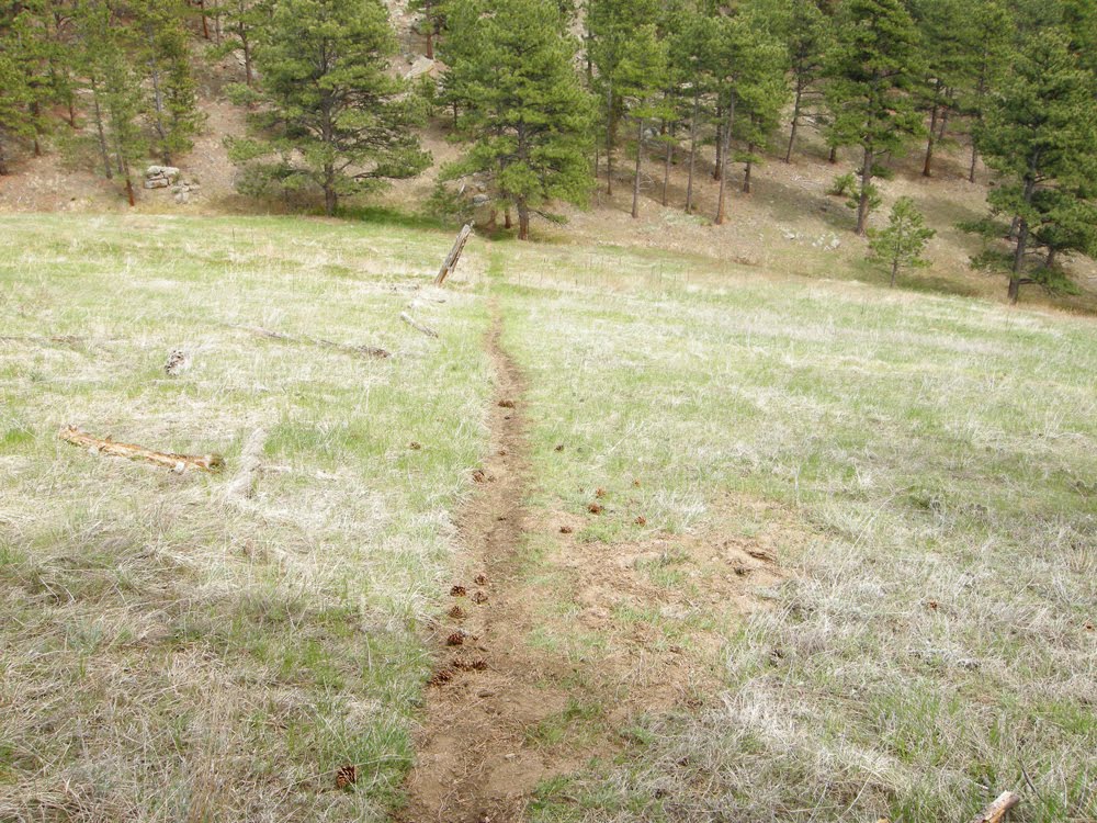
Social trail above Cathedral park


Further up there is a spring. If the trail goes between it and the road it would traverse this slope.


Above the spring the trail would head West and cross the drainage to this view


Turning SW to follow the ridge, an old trail with switchbacks appears


The track intersects the road  near the crest

Friday, August 27, 2010

Proposed trail near Long Canyon

This route will likely be discussed in future meetings. It would climb the ridge North of Long Canyon and connect up with the Green Mountain West Ridge trail.  Click on a picture enlarge it.


If the trail starts climbing before the mouth of Long Canyon it would likely head up through this area.


Another option is to follow the Long Canyon trail a short ways as shown on the map above. Then cut up the ridge to the right just before a rock outcrop that crosses the trail. 


The goal in the distance.


The route on the map parallels the road, eventually crossing a drainage near its head just below this old car.


The route then climbs to the Southwest between Flagstaff road and Long Canyon. It meets the Long Canyon trail as it climbs towards the road.


At the road the route could follow an old dirt road.


It would logically follow some old switchbacks climbing toward the ridge.


Many feathers were found.


The route hits the ridge and bends towards the East to connect with the Green Mountain West Ridge Trail.

Monday, August 2, 2010

Proposed route of West Sanitas Trail

This route has been proposed to replace the social trail in the area. The social trails would be reclaimed.

The start off of Sunshine Canyon road would have to be reworked.


Evidence of an old switchback above a private road.


The trail would parallel Sunshine Canyon road somewhere through here.


 The trail head at the first switchback on Sunshine Canyon would connect with the proposed trail, which would continue heading North.                                                                                             


There's an old track North of the switchback. The proposed trail may follow it.


The old track fades into a field of wildflowers.


It gets rocky further up the route.  The trail should probably switchback up to the NE before this.


The route may connect up with a social trail which doesn't appear in the OSMP data base.


Near the NW corner of this part of Open Space the proposed trail would have to climb a bit to a neighborhood trail which does appear in the OSMP inventory. This trail contours back to the SE. This part is actually a nice trail.


There are some nice views from this section.


The neighborhood trail rounds a ridge and would likely contour around to the ridge North of Mount Sanitas - beyond the trees here.

Tuesday, July 20, 2010

Comment Gathering Web Site Launched

The Boulder West TSA neighborhood representatives have just launched a new and improved website for gathering your comments and updating you on the latest developments in the CCG process. This website can be reached at:

http://west-tsa-neighborhood-comments.blogspot.com/

If you're interested in learning more about the CCG, process, adding your name to our mailing list, contributing your insights, or commenting on the various ideas being considered, this is the place to go.

With a few exceptions (listed below) this blog contains older and often outdated information.

Monday, July 5, 2010

Meeting for neighbors who live in the “central” neighborhoods of the West TSA

The Community Collaborative Group (CCG)* is now actively considering a broad range of suggestions for improving the way in which Boulder Open Space and Mountain Parks (OSMP) manages the so-called "West Trail Study Area" (West TSA), which are comprised of OSMP properties in the area north of Eldorado Springs, south of Linden, and west of Broadway / Colorado 93.

Under consideration are suggestions about expanding and/or restricting various types of recreational access with the goals of reducing adverse impacts from visitors on Open Space neighbors, improving the visitor experience while reducing user conflicts and providing physically and environmentally sustainable trail systems. Some of the issues being addressed include the rules under which dogs are allowed access to Open Space properties, the accessibility of the area to mountain bikes, and strategies for handling parking issues and social trails.

If you live west of Broadway/north of Table Mesa/south of Canyon you are considered to be a “neighbor” in the central region of the West TSA. The neighborhood representative for the central region is Shelley Dunbar and she will be hosting an open forum to gather neighbor input on the proposals that will be put forth in the upcoming CCG meetings. If you are interested in voicing your ideas for “on the ground” actions that you would like to see in the West TSA, please join Shelley Dunbar at this neighborhood meeting.

Where: Chautauqua Park “Rocky Mountain Climber’s Club” room (lower level of the Community House)
When: Monday July 19th at 6:30 PM

Please come prepared to share your specific, well-thought out solutions to issues you have as a “neighbor” of Open Space! If you are unable to attend this meeting, you can email your ideas directly to the neighborhood rep at shelley.westtsa@gmail.com.

* To find out more about the Community Collaborative Group go to http://www.bouldercolorado.gov/index.php?option=com_content&view=article&id=11843&Itemid=3763

Change in Time and Location of the July 7th CCG meeting

Change in Time and Location for the July 7th CCG meeting
Please note that the Wednesday July 7th CCG meeting will be held at the West Senior Center at Arapahoe and 9th street (not Cherryvale). We also have a new meeting time, starting at 5:30 and concluding at 9:30pm. Public participation is scheduled for the start of the meeting, so if you plan to speak please arrive by 5:30 PM.
Agenda for this meeting
The agenda is to finish the discussion of proposals for the Sanitas / Anemone Hill / Red Rocks Sub-area. It is important for the CCG to strive for tentative agreement on as many of the proposals as possible, so that the CCG can move on to the next sub-area.
· At Wednesday's meeting it is possible that the CCG will finish the Sanitas / Anemone Hill / Red Rocks Sub-area before the end of the meeting. If that is the case, the CCG will begin discussion of ideas and possibilities for the Western Mountain Parks / Flagstaff Sub-area, with the starting point being proposals already made by CCG members.

Monday, June 14, 2010

Undesignated trails West of Sanitas

Below are some pictures of undesignated (social) trails West of the Sanitas area.  These trails are currently being discussed by the CCG. They could be left as is, some of them could be reclaimed, some of them could be re-routed, and some of them could become designated.

The ridge North of Mount Sanitas


Outcrops along the ridge


Looking East back towards the Mount Sanitas ridge


Looking West from the high ridge in the Northern part of the undesignated trail area.


Undesignated trail heading NW in the Northwestern part of the area.


Heading back towards Mount Sanitas ridge along the fence line


Steep part of the trail back up to the ridge.

Wednesday, May 5, 2010

June 10 Board of Trustees Meeting

At the June 10 Open Space Board of Trustees meeting the South Boulder representative to the Community Collaborative Group, Scott Gordon resigned and I, as the alternate, was appointed by the Board to take his place.

Also, based on comments received, I have withdrawn the prior materials that I had written.

In consultation with the OSMP staff, the CCG facilitator, the other neighborhood representatives, I will be putting together a plan for better representing the interests of the caucus. I will be sending out this plan, with a request for comments and suggestions, as soon as possible.

Guy Burgess


Friday, April 30, 2010

Notes from the Neighborhood Listening Session April 7th

The second neighborhood Listening Session was held at the Chautauqua Community House on April 7th. Around 90 “neighbors’ of the West TSA showed up to participate. Neighbors were asked to frame their input as suggestions of “what they would like to see” as a future condition in the West TSA. The following is a compilation of the input we received that evening.

Parking

  • Better education & enforcement of designated parking areas in Chautauqua.
  • Add more parking on the north end of the Chautauqua meadow.
  • Address the parking situation on Eldorado Springs Rd at Dowdy Draw.
  • Address parking (dangerous) and social trails along Baseline; find a way to direct users to designated trails so that there is less use of social trails.

Trail maintenance/trail closures

  • Temporary (seasonal) closures for trail conditions that warrant it – in particular, very muddy trails.
  • Closure of the 3rd & 4th St trail when muddy
  • Add gravel to trails that are prone to muddiness.
  • Harden the trail surfaces against mud where possible.
  • Increased, aggressive, proactive trail maintenance.
  • Have OSMP coordinate with the various users groups to get their participation in maintaining trails and in helping with the upkeep of the trailheads and trails that they use.
  • All trail closures justified and monitored for “need” on a regular basis.

Trail access & trails (general)

  • Maintain the status quo in the West TSA
  • Bike parking (bike racks) at all/most trailheads.
  • Encourage people to ride bikes or to walk to trailheads rather than drive.
  • Maintain access to the West TSA.
  • Designate a trail between the Enchanted Mesa and the McClintock trails – tentatively named the “Enchanted Vista” trail.
  • Allow neighborhood volunteers to post relevant and timely information on the trailhead “reg” boards.
  • Increase ADA trail access.
  • Education of users about their noise impact on neighbors - especially at trailheads.
  • Create an “alternating use schedule’ in the style of Jefferson County’s “Centennial Cone Park “ – essentially a calendar of use for hikers and bikers.
  • Designate the Goat Trail.
  • Maintain trail access for NOAA/NIST/NCAR employees.
  • More access points
  • Create more trails to achieve less crowding/congestion
  • Fewer signs
  • Fewer internal fences

Trails - trail design and trail designations

  • Establish which social trails should stay and which should go; the ones that are to be kept need to be sustainably designed and maintained.
  • Be mindful that the common denominator of trail use in the West TSA is “walking”.
  • OSMP should use up-to-date, sustainable trail building practices.
  • Designate small, meandering social trails – use the social use as an indicator of desirable user experiences.
  • Designate trails by user type to avoid user conflicts.
  • Design trails to reduce user conflicts.
  • Better quality of single track trails – both hiking and biking trails
  • Build trails that do not encourage users to trespass on neighbor’s property.

Preservation & Conservation

  • Better seasonal signage
  • Reduce invasive weed species. Preserve wildlife corridors in the area of Shanahan Ridge 4 and others.
  • Maintain existing Voice & Sight and explore options for more V & S trails.
  • Dusk-to-dawn closures of HCAs and Natural Areas.
  • Conserve and preserve the area between Walker Ranch and Eldorado.

Mountain Bikes

  • Designate a north/south mountain bike trail (trail from Chautauqua to Eldorado) that would be a “single use” trail.
  • Reaffirm the prohibition of mountain bikes west of 93 & Broadway.
  • A possible mountain bike trail from Green Briar to South Boulder Creek Trail.
  • Access to mountain biking trails that can be accessed from home without having to drive to the trailhead.
  • Manage bike access specifically for neighbors, not as a destination for users who are not neighbors.
  • Loop trail for mountain bikes in the southern part of the West TSA.
  • Mountain bike trail between Boulder and Walker Ranch
  • Communication with Shanahan 6 neighbors and priority to be given to those neighbors living near proposed mountain bike trails.
  • Sustainably built north/south single track mountain bike trail to be built.
  • Make use of existing fire roads to accommodate mountain bike users.
  • Development of a “bike etiquette” program to educate bike users with the objective of decreasing user conflicts.
  • Implement a speed limit on all bike trails of 20 mph max with a 5 mph “passing” speed limit.

Dog Walkers

  • More Voice & Sight trails
  • Maintain existing Voice & Sight trails.
  • More enforcement of the Voice & Sight regulations.
  • Need more education about not leaving poo bags behind, more community “poo clean up” days, more trash bins and poo bag dispensers at trailheads.
  • Expansion of the trailhead leash program (leashed for first 100 yards of the trail) to all trailheads.
  • Education about “packing out” dog waste.
  • Dog leash regulations to extend to Thomas Lane (West part of South Boulder Creek Trail / Big Bluestem area).
  • During ground nesting bird season have seasonal leash regulations.

Miscellaneous

  • Reintroduction of extirpated species such as antelope (“extirpated species” are those that are no longer existing in a specific location such as the West TSA, but are not extinct as a species.)
  • Affirmation of the Open Space charter.
  • Better enforcement in Eldorado Springs and a budget for emergency response needs to be adequate to the use and more aggressive fire and pine beetle mitigation plan.
  • Explore a fee system for non-Boulder county users.
  • Direct communication with neighbors who have given their emails to OSMP for the West TSA (West TSA list-serve).
  • Discourage use of headphones on trails.

Thursday, February 25, 2010

Hello,

The CCG has completed the formal learning phase and is now moving into establishing our Desired Future Conditions. In order for the neighborhood reps to best serve you we have developed a survey for the residents who live west of Broadway or with-in one-half mile of OSMP lands affected by the west TSA. These are the areas the Open Space Board of Trustees has intended the CCG Neighborhood Reps to serve, Thank you for observing the Trustee's intentions and the honor system.

http://www.surveymonkey.com/s/WestTSAneighbors


Please help us distribute the link to additional community members and leaders like HOAs, etc who are in the intended area.

If you'd like to provide more feedback please feel free to email it to us at:
Westtsa.reps@gmail.com

We recognize that every survey has its limitations and flaws. That said we've drawn guidance from topics that have arisen in the CCG process and themes voiced by neighbors in prior outreach. From there, we've put in quite a bit of effort to find the balance between drilling down for details and keeping the survey to a manageable size.

If it proves helpful, we may use similar tools for gaining feedback to incrementally more specific concepts as we progress through the CCG process.

Thank you for your time and community involvement.

Tuesday, January 26, 2010

North Boulder West TSA Neighbors Field Trip - January 30, 2010 @ 1PM

The West TSA CCG has been meeting about twice per month for the last few months. These meetings have largely been informative, meaning that much of the time has been spent being briefed by OSMP on the current state of the West TSA system. We are now moving into the next phase where we need to bring forward our 'Desired Future Conditions'. For Joe Zamudio and I to best represent the desires of our North Boulder neighbors, we need to hear from you.

Some of you have provided some written or verbal desires to us previously. However, Joe and I (and the other Neighborhood CCG Reps) thought it might be helpful if we could visit with you personally; to have you show us precisely what your neighborhood-related Open Space issues are (trash, parking, congestion, noise, access points, animals, social trails, etc), to see these items from your point of view, and to hear possible solutions that you might be interested to bring forward. We also desire discussion regarding items that you think are working well and that you recommend not changing.

As outlined by the West TSA, our focus is on individuals living north of Canyon, west of Broadway, and south of Linden. So if you live in this general area and have 'desired future conditions' that you would like voiced during the West TSA planning process, please come meet us for an afternoon excursion around our North Boulder Open Space on Saturday January 30, 2010. The plan is to meet at the Centennial Trailhead parking lot on the south side of Mapleton/Sunshine Canyon) at 1 PM.

When: January 30, 2010 (Saturday), 1PM
Where:
Centennial Trailhead on Mapleton/Sunshine Canyon
What to bring: Ideas to share, walking shoes, warm clothes, water, bike
Who:
Anyone, really - but focusing on North Boulder West TSA neighborhoods

Due to the relatively short notice for this invitation, we plan to provide at least one more opportunity like this during this phase of the CCG process (likely either February 20 or 21, weather dependent).

We hope that you'll take the time to come educate us so that we can properly represent your desires in this West TSA planning process. Please pass this information on to your neighbors if you think they'd be interested.

We sincerely look forward talking with you on Saturday.

Regards,

Ned Patton and Joe Zamudio

Sunday, December 6, 2009

A field trip stop viewed from space

Chautauqua was scheduled to be one of the last stops of the cancelled field trip.  However, this site is best viewed from above. A Google satellite image shows a real neighborhood issue - several undesignated trails accessing Chautauqua from the neighborhood below. Many access points are marked by red arrows in the image below.  (Try clicking on the image to enlarge it.)


The next image shows more of the undesignated trail network - sub-parallel trails across Chautauqua meadow.