This route will likely be discussed in future meetings. It would climb the ridge North of Long Canyon and connect up with the Green Mountain West Ridge trail. Click on a picture enlarge it.
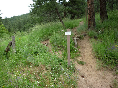
If the trail starts climbing before the mouth of Long Canyon it would likely head up through this area.
Another option is to follow the Long Canyon trail a short ways as shown on the map above. Then cut up the ridge to the right just before a rock outcrop that crosses the trail.
The goal in the distance.
The route on the map parallels the road, eventually crossing a drainage near its head just below this old car.
The route then climbs to the Southwest between Flagstaff road and Long Canyon. It meets the Long Canyon trail as it climbs towards the road.
At the road the route could follow an old dirt road.
It would logically follow some old switchbacks climbing toward the ridge.
Many feathers were found.
The route hits the ridge and bends towards the East to connect with the Green Mountain West Ridge Trail.
Our role in planning for Open Space & Mountain Park lands just west of town...
1. Learning the interests of those who live near Open Space
2. Bringing those interets to the planning process
3. Searching for mutually beneficial solutions
2. Bringing those interets to the planning process
3. Searching for mutually beneficial solutions
Friday, August 27, 2010
Monday, August 2, 2010
Proposed route of West Sanitas Trail
This route has been proposed to replace the social trail in the area. The social trails would be reclaimed.
The start off of Sunshine Canyon road would have to be reworked.
Evidence of an old switchback above a private road.
The trail would parallel Sunshine Canyon road somewhere through here.
The trail head at the first switchback on Sunshine Canyon would connect with the proposed trail, which would continue heading North.
There's an old track North of the switchback. The proposed trail may follow it.
The old track fades into a field of wildflowers.
It gets rocky further up the route. The trail should probably switchback up to the NE before this.
The route may connect up with a social trail which doesn't appear in the OSMP data base.
Near the NW corner of this part of Open Space the proposed trail would have to climb a bit to a neighborhood trail which does appear in the OSMP inventory. This trail contours back to the SE. This part is actually a nice trail.
There are some nice views from this section.
The neighborhood trail rounds a ridge and would likely contour around to the ridge North of Mount Sanitas - beyond the trees here.
Subscribe to:
Posts (Atom)


