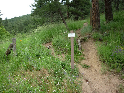
This route has been proposed to replace the social trail in the area. The social trails would be reclaimed.
The start off of Sunshine Canyon road would have to be reworked.
Evidence of an old switchback above a private road.
The trail would parallel Sunshine Canyon road somewhere through here.
The trail head at the first switchback on Sunshine Canyon would connect with the proposed trail, which would continue heading North.
There's an old track North of the switchback. The proposed trail may follow it.
The old track fades into a field of wildflowers.
It gets rocky further up the route. The trail should probably switchback up to the NE before this.
The route may connect up with a social trail which doesn't appear in the OSMP data base.
Near the NW corner of this part of Open Space the proposed trail would have to climb a bit to a neighborhood trail which does appear in the OSMP inventory. This trail contours back to the SE. This part is actually a nice trail.
There are some nice views from this section.
The neighborhood trail rounds a ridge and would likely contour around to the ridge North of Mount Sanitas - beyond the trees here.


No comments:
Post a Comment
Note: Only a member of this blog may post a comment.